
18.5 miles
Elevation gain: 1750 feet
Snowmobile route numbers (in order from Fish Lake Sno-Park): 2, 6, 6A, 8A, 8B, 7B, 7A, 7, 2
A high ridge near the Entiat Ridge on powdery tracked snow that sparkles in the morning light. Then a long descent winding three gentle miles, and then two additional screaming miles, to the bottom of the Chiwawa River valley.
This loop is one of my favorites. But it comes at a price: 1700 feet of vertical up the never-ending hills south of Alder Creek. Of course, you can reverse the loop and come down these hills, but then you have to trudge up the other side on the western slopes of Maverick Peak. Pick your poison.
I usually go up the Alder Creek route, making this a clockwise loop. This is because I would rather zip down than grunt up Route 8B. Also, because of the potential for snowmobile traffic, the Corkscrew (see below) is safer going up than going down. (I have encountered a snowmobile on the Faultline Loop only twice. Ever. But ASS comes with the inherent risk of snowmobile traffic at any time.)
To access the main Faultline trail (what the Forest Service calls Route 8A), ski 1.1 miles toward Trinity from the Fish Lake sno-park along Route 2, and take a right toward Goose Creek Campground to the large four-way intersection. From here, head slightly left and slightly uphill onto the Alder Creek access trail (Route 6). Work uphill (250 feet elevation) 1.2 miles and turn downhill and right onto Route 6A – Valeria Way.
Valeria Way is one of the small gems of the Fish Lake area. Relatively flat, it covers a short 0.7 mile through alder, puffberry, dogwood, and vine maples. These trees drop their leaves in autumn only to adorn themselves with snow in the winter. Their white coats always seem thicker here than in other parts of the forest. Maybe this stretch is protected from the wind. Or maybe it is just that the trail is so gentle that I have time to look up and notice.
After 0.7 mile on Valeria Way, turn left onto the main Faultline trail (Forest Service Route 8A) and begin your workout. The trail takes only the shortest breaks in its job of gaining elevation, but the incline is gentle enough to keep skiing. In 2 miles (5 miles from the car) the trail steepens as it doglegs up right, then left, through The Corkscrew. I have never encountered a snowmobile on the Corkscrew, but because of the local terrain it might be possible for one to approach without you hearing it. So watch out.
The climb continues around a knoll between Alder and Elder creeks and takes a right-hand bend to trend generally southeast. After a sharp dogleg to the right, you top out with views to your right across the Chiwawa River valley to Big Jim Mountain, Chiwaukum Ridge, and Nason Ridge. The elevation here is about 3750' (the Fish Lake Sno-Park is at 2000'). Total distance to here is about 8 miles.
Now comes the treat: a long glide down. The way is steep enough to get some zip going, without being so steep as to require snowplowing around the bends. Turn right at the next intersection (12.9 miles from the car) onto Route 8B. (The left-hand route takes you onto the Beaver Creek Loop (Trip #13). If you go this way add a net 8.4 additional miles to your trip.)
Route 8B screams down to Burgess Meadow in 1.9 miles. Take a right onto Route 7B and continue on 7A, 7, and then 2 back to the car. The odds increase of having a snowmobile zip past you on this last leg of the loop, but if you follow ASS Rule #1, there should not be a problem. On the return, your odds of encountering a snowmobile on routes 7 or 7A are about 30%. The last 1.1 mile on Route 2 will almost assuredly show tracks of a machine or two. But by this time you are almost home and ready for breakfast.
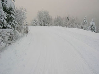
Approaching the high point along the Faultline Loop