
20 miles RT
Elevation gain: ~2200 feet (high point 3800 feet)
This variation to the already-classic Pole Ridge route just adds a little spice to the trip. The idea is to take the left fork at Junction R, at about 6.6 miles into the Pole Ridge route, onto what the Forest Service calls Route 4D. This 2.4-mile trail is one of the prettiest in the system, taking you downhill through hillsides that have been thinned but not cleared. On a sunny morning the red-orange bark of the Ponderosa pines look as if someone painted them with day-glo colors.
The pleasures of the trail end abruptly, however, at the bottom of MF Hill. This is a long grunt up a steeper-than-usual grade. You can use the excuse of beautiful views - down to Lake Wenatchee and across to Nason Ridge, Big Jim, and Natapoc Mountain - to stop and take a rest. At least going up is not scary. I've come down this thing in a near-whiteout, not knowing where the trail was and wondering whether I was going over the edge on the downhill side.
At about 9 miles from the car is a spur to the left - Route 4E - that goes up to Snowcone. Head up here to see what attracts the snowmobiles like bees to honey.
After visiting Snocone, return to Route 4D and take it to Junction S. Turn left onto Route 4F, rejoining the regular Pole Ridge route just in time for the zippy ride down to the elevation of Meadow Creek, with nearly 2000 feet of elevation loss.
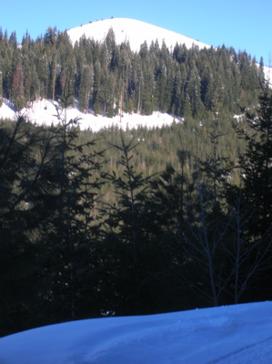
Snowcone as seen from lower on the Pole Ridge trail.
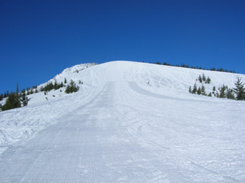
Snowcone up close - the groomer does not always go all the way to the top.
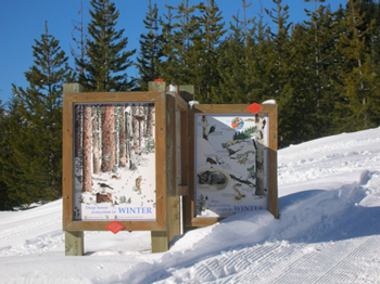
There is a US Forest Service information board about tree growth and wildlife up near the top of Snowcone. After you have been skiing several lonely miles, it seems weirdly out of place.